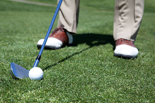
On the golf course, similar scenes are not uncommon: a swing that feels good, but the ball inexplicably hits short and stops in the bunker in front of the green; Or they misjudged the distance of the water barrier in front of the green, causing the little white ball to unfortunately go into the water. These moments of frustration are often closely related to mistakes in distance judgment.
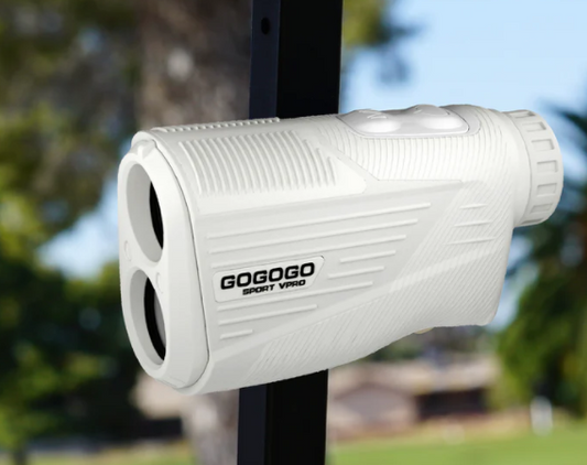
Accurate distance information is undoubtedly a key prerequisite for playing golf well. The error in visual distance estimation often causes headaches, and laser rangefinders are frequently restricted by aiming conditions. So, how accurate is the GPS golf rangefinder, which is increasingly favored by golfers nowadays? Can it really solve our pain points in distance judgment?
This article will delve deeply into the accuracy of GPS golf rangefinders, explain their working principle, error range, and influencing factors, and provide you with methods to maximize the use of their precision to improve your performance.

How Does a GPS Golf Rangefinder Work?
The core principle of the GPS golf rangefinder is to utilize the satellite network orbiting the Earth, including the well-known GPS. Some devices also support other satellite systems such as GLONASS, Galileo, and Beidou.
The key steps of its work are as follows:
- Receiving signals: The GPS receiver inside the device captures signals sent by multiple satellites.
- Triangulation calculation: By calculating the time difference of signal propagation from the satellite to the device and combining it with the precise position information of the satellite itself, the longitude and latitude coordinates of the device on the Earth can be calculated.
- Course map matching: Such devices usually come pre-installed or allow users to download high-precision digital course maps, which precisely mark the coordinates of positions such as the center of the green, the front and back edges, bunkers, water obstacles, and key points of the fairway.
- Distance calculation: The device calculates the "straight-line distance" based on its own positioning coordinates and the coordinates of target points on the map (such as the center of a ridge, the front edge of a sandpit, etc.) using geometric formulas (usually the formula for the straight-line distance between two points).
It should be made clear that the GPS golf rangefinder provides the horizontal straight-line distance from the current position of the device to the preset target point on the map. This means it is neither the slope distance nor the precise distance to the flagpole - unless the device has a green view and the function of manually positioning the flagpole.

How Accurate Is a GPS Rangefinder Exactly?
Overall accuracy range
Under the premise of good signal and accurate stadium maps, the distance reading error of mainstream consumer-grade GPS devices (including watches, handheld devices, mobile apps, etc.) is usually within 3 to 5 yards (about 2.7 to 4.6 meters).
For some high-end devices or those that adopt differential GPS technology, their accuracy can be further enhanced to 1-3 yards (approximately 0.9-2.7 meters) or even higher.
Compared with other distance measurement methods: This accuracy is usually better than the visual estimation of experienced golfers (the visual estimation error may reach more than 10-20 yards). Although there is a gap compared with the centimeter-level accuracy of laser rangefinders under ideal conditions (which can clearly aim at the flagpole), it is sufficient to meet the needs of the majority of amateur golfers in their club selection decisions.
What is the key to "accuracy"?
- The positioning accuracy of the device: This is closely related to the performance of the device's own GPS chip, as well as the number of satellites currently received and the signal strength. Devices that support multi-satellite systems (such as GPS+GLONASS, etc.) usually have more stable positioning and higher accuracy.
- The accuracy of the stadium map: This is one of the most crucial factors affecting the actual usage accuracy of GPS rangefinders. Whether the collection of map data is professional, whether the marking of coordinate points is accurate, and whether the map update is timely (for example, if the position of the ridge may change after the renovation), all directly affect the distance value that users see. Generally speaking, well-known brands will invest a lot of resources to ensure the quality of maps.
- Device position: Whether the device is worn on the wrist or held in the hand, there may be a slight horizontal distance between its own positioning point and the actual hitting point of the user, which theoretically can also affect the reading.

What is precision error?
An error of 3 to 5 yards is roughly equivalent to a little more than the length of a push rod. For a green 150 yards away, such an error usually does not lead to a disastrous mistake when choosing a club (for example, whether to pick a 7-iron or an 8-iron). However, when precise flag strikes are required (for instance, avoiding the bunkers near the green) or when making short cuts, it is necessary to combine the green view to determine the landing area.
At the same time, it is necessary to clarify the difference between GPS rangefinders and laser rangefinders: Laser rangefinders measure the precise distance from the device to the flagpole (or the object aimed by the user), provided that the target can be seen and aimed stably. The GPS rangefinder provides the distance to the preset point on the map (such as the center of the ridge). The measurement targets of the two are different, each having its own advantages and limitations.
How Can The Accuracy Of GPS Rangefinders Be Utilized To Enhance Performance?
1. Clarify its advantageous scenarios
- Quickly obtain key distances: Be able to quickly know the distances to key positions such as the front/middle/back of the green, bunkers, and water obstacles. This kind of information acquisition does not require aiming and can be obtained instantly. It is especially suitable for use in situations such as blind shooting, when the target is blocked, or when the slope undulations affect visual inspection.
- Global vision: It can provide a comprehensive view of the fairway and the location information of obstacles, helping players formulate more reasonable hitting strategies and choose safer landing points.
- Club selection efficiency: Quickly provide accurate distance information to reduce the player's hesitation when choosing a club, thereby accelerating the playing speed.
2. Enhance the usage effect
- "To the center of the green" rather than "to the flagpole" : This is the point that is most likely to cause misunderstandings! It is necessary to combine the "Green View" function provided by the device. If the device supports it and the map has this function, the position of the flagpole can be manually located. If it is not supported, you need to determine based on the green view that the flagpole is approximately in the front/middle/back of the green, and then estimate the distance to the flagpole by yourself in combination with the distance to the front/middle/back of the green.
- Non-linear distance: The GPS rangefinder provides a horizontal distance and does not take into account the slope factor. Therefore, the actual distance will be longer when going uphill and closer when going downhill. Players need to adjust it according to the actual situation.
- Signal interference: It should be avoided to use in tall trees, buildings or deep valleys, as these environments can cause signal deterioration and thus reduce accuracy. Try to choose an open area for positioning.
3. Practical skills
- Prioritize the use of the green view: Be sure to learn to use this feature, as it is the key to reducing the actual distance error from the flagpole.
- Combining visual observation with experience: Take the distance provided by GPS as the core reference, and at the same time, make fine adjustments based on visual observations of the flagpole position, slope, and wind force, as well as your own playing experience.
- Pay attention to relative distance: Even if there is a slight error in absolute distance, information such as the distance difference between the front and back edges of the bunker and the distance difference between the front and back edges of the green is usually very reliable. This is crucial for determining whether one can cross the obstacle and land in the safe area of the green.

The End
With the support of good signals and high-precision maps, the accuracy of mainstream GPS golf rangefinders is usually within 3 to 5 yards, which can effectively solve the core pain points of golfers: quickly obtaining key obstacles and green distances, reducing visual estimation errors, and enhancing confidence in club selection and strategy formulation ability.
The GPS rangefinder provides distance information without aiming pressure, fast and comprehensive, especially in scenarios where lasers are difficult to use, its advantages are obvious. By rationally understanding its working principle and limitations and making good use of functions such as the green view, it can be regarded as a powerful decision-making aid rather than the sole basis for absolute accuracy.
For golfers who pursue convenience, strategy and overall distance control, GPS rangefinders are a cost-effective choice for improving performance and enjoying the game. When making a purchase, priority should be given to the accuracy of the map and the update service to make every decision more confident and stable.